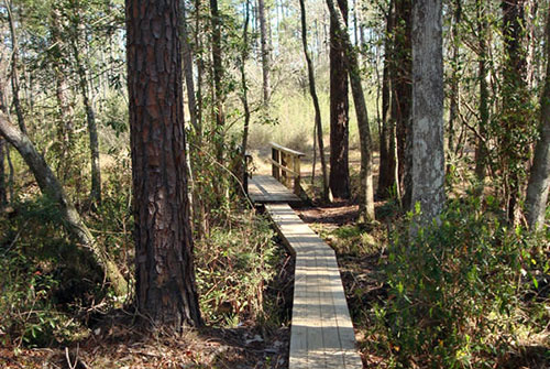
De Soto National Forest’s Tuxachanie Trail boasts 12 miles of gorgeous South Mississippi wildlife and scenery — including pine savannahs, swamps and a variety of native flora, including carnivorous pitcher plants. Visitors entering the trail are treated to a beautiful row of live oaks planted in 1935. The first five miles of trail after on the west side follow an abandoned railroad line built in the early 1900s by Irish immigrants. The trail is fairly flat, making it easy walking for adults and children alike, and includes several sections of elevated wooden footbridges.
Directions
From Hattiesburg, MS
US HWY 98
From US Hwy 98, take US Why 49 South towards Gulfport (45 miles).
Turn right onto Glen Lott Road (0.3mi) and then left onto McHenry Ave/Old Hwy 49 (1mi).
In 0.3 miles, turn left onto Pine Street. Then, turn left at the first cross street onto US 49 North. The trailhead will be on the right.
From Gulfport, MS
Interstate 10
From I-10, turn onto US Hwy 49 North towards Hattiesburg and continue straight for approximately 21 miles through Saucier, MS. After passing HWY 67, the trailhead is ahead on the right.